By Isaac Welch
Howard University News Service
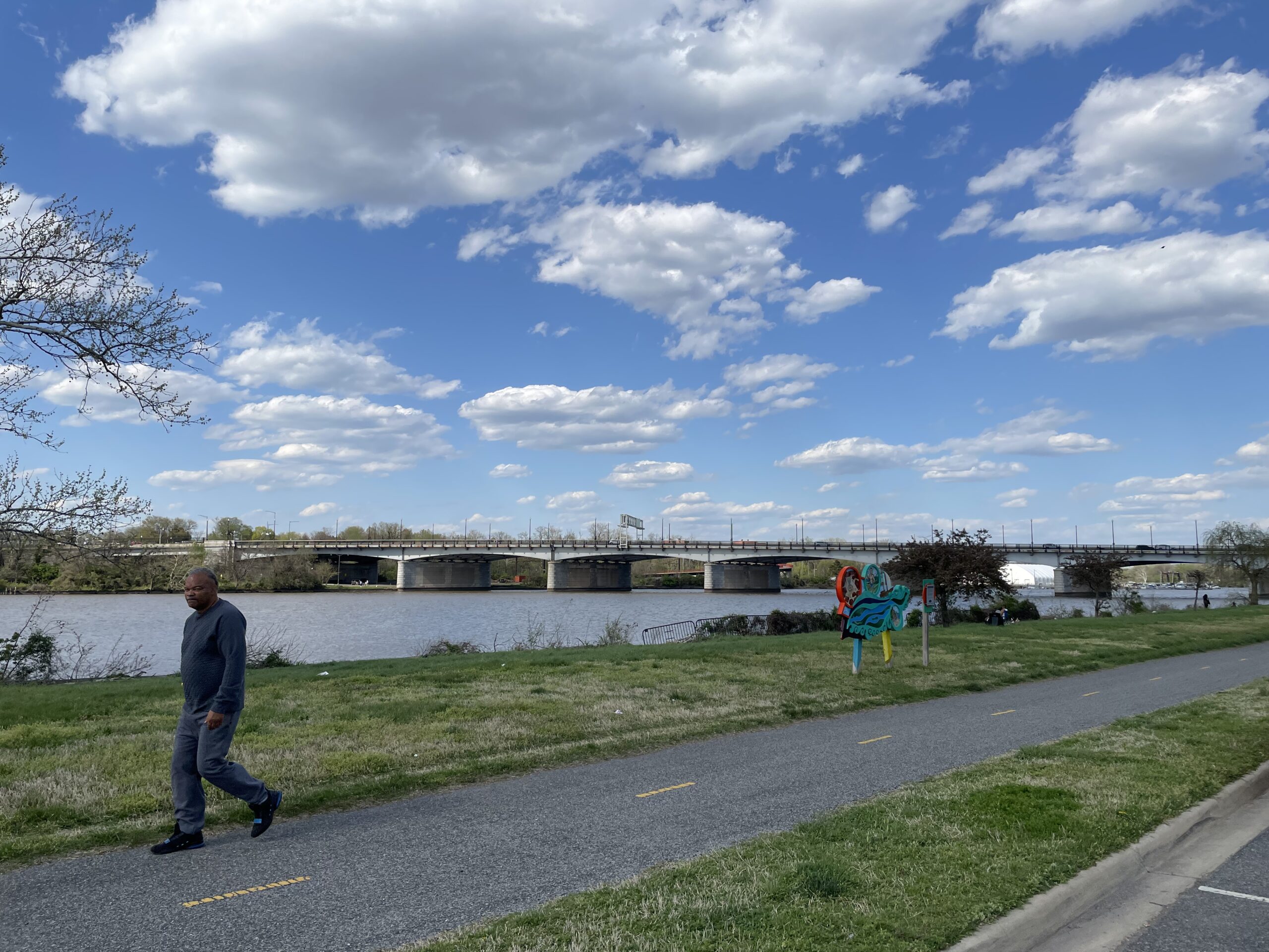
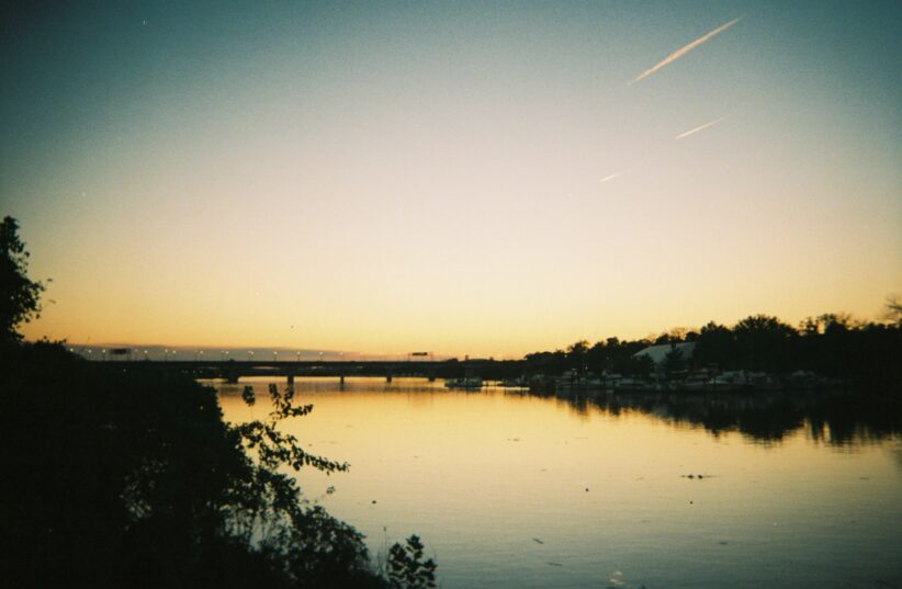
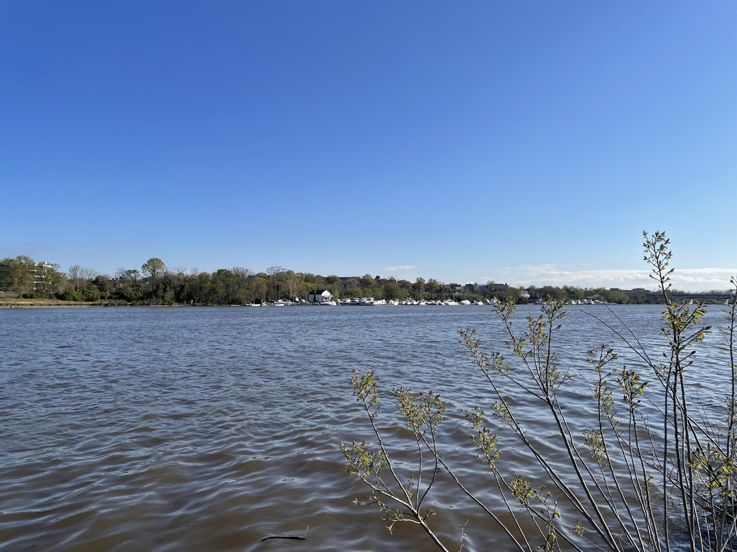
Running 8.5 miles from Bladensburg, Maryland, to Hain’s Point in Washington, D.C., the Anacostia River complements the Potomac as one of the defining natural elements of the nation’s capital. Once the setting to a thriving, wealthy Native American tribe and now a destination for outdoors folk and a muse to nature enthusiasts, the Anacostia River has endured substantial changes. Above all, it has been adversely affected since European colonization began in the 17th century through industrialization of the 20th century that combined to drain the water of its purity.
“The Anacostia River was horribly polluted,” said Chris Williams, CEO and president of the Anacostia Watershed Society.
Under the care of environmentalist groups such as the Anacostia Watershed Society and the Anacostia River Keepers, the river has steadily improved. The question remains, how will the river’s transformation impact the populations who have been affected by malpractice and negligence that have led this historic cityscape and its biome to decay?
Nacotchtanks Celebrate River as Their Life Force
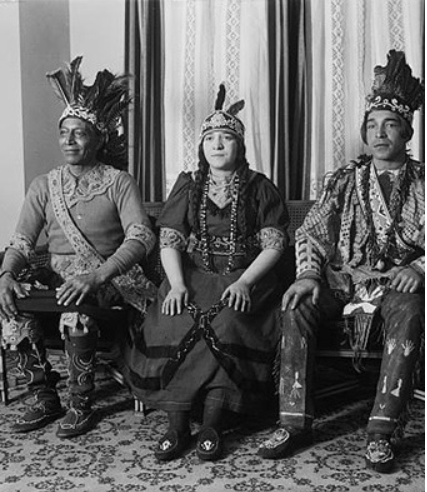
In the time leading up to the 17th century, the Algonquian-speaking Nacotchtank tribe lived as the core inhabitants of the wetlands surrounding the Anacostia River. Concentrated on the southeastern side, they celebrated the river as their life force. The river provided them with a diversity of fish and wildlife, with its wetlands fertile for crops such as squash, beans and potatoes.
“The name Nacotchtank, derived from a native term meaning “town of traders,” as it were that the river created a crossroads where other tribes would come to barter. The name of the tribe and the township that controlled these areas evolved from Nacotchtank, to Nacostine, and finally to Anacostan, by which the river today is named after. However, alongside these etymological evolutions came adverse changes for its native peoples and their environment.”
The introduction of European immigrants to the area brought conflict and disease. By the mid-17th century, the local Native American population had been reduced to a quarter of what it had once been. The Anacostan tribe was forced out from the land they had cultivated for centuries, and by the 18th century, the river’s headwaters in Bladensburg, Maryland, became a trading center for European immigrants. The industrial centers brought up along the river’s banks introduced unadulterated pollution to its waters, beginning the centuries-long process of degradation to this ecosystem.
These trends continued through the 20th century. Concurrently, Washington was undergoing substantial demographic changes as well. By the 1980s, the vast African American population that had amassed to earn D.C. its nickname as “Chocolate City,” began its decline. Through mal-intended zoning practices and urban planning, African Americans became displaced all over the district, finding themselves concentrated in areas “east of the river” in Wards 7 and 8.
Historically, these wards have sustained higher levels of crime, and lower levels of income, education, and economic opportunity than their counterparts across the river. These factors, bound to a biosystem declining in health, have plagued Anacostia, its river and its surrounding areas in Wards 7 and 8 with a rather negative reputation. It is these factors that led Robert Boone to found the Anacostia Watershed Society (AWS) in 1989.
“Fishing had been banned; swimming had been banned,” the society’s current CEO and president, Chris Williams, says of the river. “Most people didn’t even interact much, because it was so polluted. It had a reputation as a place you didn’t go, because it was associated with neighborhoods where some folks didn’t want to be, or they felt were unsafe, and whether that was true or not, that was its reputation.”
Today, the AWS is working to reverse the conditions that brought about this perception. Through a combination of policy work, youth and adult education, and community-based field work, the AWS aims to make the Anacostia River both swimmable and fishable by 2025.
“It could be swimmable, but I don’t see it being there in three years,” contends longtime Ward 8 resident Alvin Allen, 54, “I mean I’m not a scientist or anything, but in three years I don’t see a human swimming and not getting sick in this water. I mean you have many, many years of decay and pollution.
“The park has been getting better over the past several years,” Allen adds. “There’s still plenty of trash, but this side has always been home to me. In the ’80s and the ’90s, this park was jumping. I used to walk down here as a kid from Parkland. That was a long walk, but we always had fun over here.”
According to the Environmental Protection Agency (EPA), a river or other recreational body of water is declared swimmable and fishable once cyanotoxins in the water and in fish tissue are held below a certain threshold as discerned by the 1972 Clean Water Act.
“The EPA’s recommended AWQC/SA recreational ambient water quality criteria or swimming advisories identify the following concentrations of microcystins and cylindrospermopsin that would be protective of human health given a primary contact recreational exposure scenario: 8 µg/L for microcystins and 15 µg/L for cylindrospermopsin. For both cyanotoxins, the recommended duration and frequency depend on their application as a water quality criterion or a swimming advisory. (µg = microgram),”
Historically Marginalized and Last in Line
As the AWS strives toward meeting this goal, Williams remains conscientious of the impact that improving the health of the river could potentially bring to its surrounding demographic.
“Historically speaking, the Anacostia Watershed Society has been involved with both environmental and racial justice, and they’re sort of built on each other,” Williams said. “If you look at the planning of water resources and pollution control in D.C., Wards 7 and 8 and areas down by the river tended to be last in line. You have a neighborhood that was historically marginalized and was more subject to the ravages of the pollution and, of course, that made the area less desirable.
“As the river comes back, it does bring greater economic activity back to the river — particularly on the west side of the river. You’re seeing a lot of economic development with The National’s park, restaurants, office buildings and luxury condominiums all being built on the river now.
“That sort of benefit is happening slower on the east side than it should. Of course, the danger there is as that happens, the very people who were negatively impacted by the river being such a mess will be the ones who will have to move out as the economy improves. That’s an equally important fight as far as AWS is concerned, to make sure that doesn’t happen.”
Williams calls and responds to a fear shared by many citizens in the wards across the river. With the addition of new infrastructure, the destruction of those long standing, many citizens feel as though changes occurring in neighborhoods like Anacostia, Capitol Heights and Barry Farms, are ushering in a new demographic. And the purification of the river is an extension of that.
One point of reference that maintains this belief is the proposed 11th Street Bridge Park, which aims to unify the Navy Yard area and the Anacostia Watershed with a venue for recreation, education, arts and performances. This concept has brought about skepticism from local residents and drawn comparison to gaudy greenspace projects such as New York City’s Highline Park.
According to Denise Rolark Barnes, D.C. native and publisher of The Washington Informer, there is a widespread belief among local residents that measures for neighborhood beautification are oft seen as suited for newcomers, but should be viewed alternatively.
“The thing that frustrates me is that when people look at the efforts that are made to change neighborhoods, we don’t assume that they’re for us,” Barnes said. “You create a bike lane, you plant trees, you clean up the Anacostia River and the mindset is that ‘oh this is for them,’ but you live here. This bike line doesn’t say for whites only; it’s just as much ours as it is there’s.”
“We’ve asked, we’ve fought, we’ve petitioned and done things as well to have these amenities in our neighborhoods without even recognizing that we paid for it,” she continues. “Everybody’s a taxpayer even if you’re just buying a carton of milk. All that contributes to the budget of the city, which is used to pay for these amenities. But they didn’t come here until they got here. So, it’s hard not to have the mindset that things that are clean and pretty, new and vibrant, we don’t think they’re supposed to be there for us. So, how do we get past that mindset?”

Ending a Negative Narrative
Putting an end to this narrative, that disadvantaged communities are powerless amid the onset of gentrification, is a major component in preventing the displacement of these peoples, though it relies on a combination of efforts.
The first is to maintain a collective understanding of a neighborhood’s identity. While consisting of many facets, Jessi Greiser, associate professor of linguistics at the University of Tennessee, explores how the language used by both residents and outsiders alike contribute to the realities created within a territory. In her book, “The Black Side of the River,” which she published earlier this year through Georgetown University Press, conclusions surmise from research focused in Anacostia.
“I have a chapter where I have people in the community talking about safety and beauty and affluence and things like that. I never approached people with any of those questions. I’m not going up to people like, ‘what do you think about the physicality of the neighborhood?’ It’s just that people respond like, ‘no, the thing I need to tell you about my neighborhood is that it’s gorgeous.’ As I’m doing [my research], what I realized was much more at stake was this idea of neighborhood identity and what it meant to be an Anacostian, what it meant to be from east of the river, and the ways those were tied in with Black Washingtonian identity.”
“People invoke the Anacostia River basin, because one of the things that the river does is it forces the topography in the way that it is on both sides,” Greiser continues. “You get those hills going up Morris Road up to Fort Stanton, and you have what as far as I’m concerned is the best view in all of D.C. for seeing the city and so people talk about it that way, and think about it as a place that people like to congregate.”
Above all, the identity of a neighborhood is defined by the livelihood of its inhabitants, but secondary to that, its culture is also largely dictated by its geology and other natural characteristics. For these reasons, a feature such as a river may have more of an underlying effect than is initially realized.
A pivotal aspect of the Anacostia River is how it serves as a natural barrier between the rest of D.C. and Wards 7 and 8. As residents outside these boundaries traverse the Frederick Douglass or 11th St. bridges, the river acts as their first impression to the environment they are about to enter.
As it has run, visibly in poor health, this initial greeting casts the reputation that has plagued the areas east of the river. In this regard, as the language and other descriptors that work to construct these notions are repeated among the general public and by those in positions of authority, the surrounding areas fall victim to a self-fulfilling prophecy wherein the landscape becomes cemented in these sordid definitions and is allowed to deteriorate under their watch.
Both Barnes and Greiser contend that conscious participation in community activism is required when it comes to asserting the presence of a pre-existing community and preserving their territories, though this component pivots on assets on a legal plane, one that Black folk in D.C. have historically endured with great disadvantage.
By the 1970s, inflation in the housing market led the median price of a house to double in the United States. In Washington, the values of properties owned by Black homeowners nearly tripled while that of white homeowners quadrupled in value. For Black homeowners, this meant an average price increase of $18,700 to $55,900, and while prices for whites increased from $33,800 to $135,000 by the end of the decade.
While both demographics saw an increase, this served as one of the early indicators of the disparities in ownership and property value that would underscore the Black and white experience in D.C. for the decades to come. During this expansion, Black homeowners took the lead on ownership of the least expensive properties while whites secured the most expensive and today, data from the Urban Institute shows that 50% of Black households own their property compared to 70% of white households.
In the 1980s, D.C.’s Black population began to decline, as socioeconomic pressures motivated many homeowners to seek dwelling in the suburban areas outside of the city, such as Prince George’s County in Maryland. Throughout these fluctuations, property values in Wards 7 and 8 stayed relatively low, and its demographics have remained majority Black and Brown. Today, Wards 7 and 8 are host to the largest number of government-subsidized housing units in comparison to any other ward in D.C.,
The second component to combating these mindsets and ending such prophecies is to increase homeownership among long-standing residents in these communities. This addresses two issues at once. On one hand, it establishes an anchor where residents of a community are less reliant on government resources and less apt to be displaced. On the other, it creates a more close-knit community of individuals who are connected and aware of the changes and or damages affecting their environment.
In Anacostia, efforts led by the Bethlehem Baptist Church behind Rev. James E. Coates, and organizations such as the Douglass Community Land Trust, are working to increase home ownership among residents. Coates, who has served Anacostia as a pastor and community organizer for over 50 years, is the founder of a new multi-use development project on property acquired through the church.
Objectively, the restoration of the Anacostia Watershed and the beautification of a cityscape’s housing and other infrastructure are developments that encourage positive change. Through the measures advocated for by Barnes, Coates, Grieser and other experts, the people of Wards 7 and 8 can ensure that the changes coming to their neighborhoods are welcomed and received to the benefit of those long-standing residents.
Isaac Welch is a reporter for HUNewsService.com and resident of Anacostia in Southeast Washington.